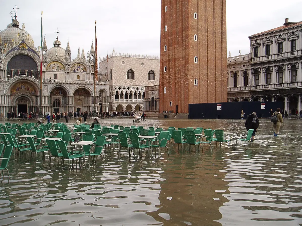
What acqua alta means for your visit
Acqua alta means "high water". Tides, wind and air pressure push the lagoon above its normal level, and water comes up through the drains and over the quay edges. The square is not a wet zone every day, but when the forecast is high, parts of it can be under water for a few hours.
The MOSE barriers at the lagoon inlets are meant to keep the worst tides out. They are not a guarantee that the square stays dry. Local protection works around the square were still under way in autumn 2026, and the forecast on the day matters more than any rule of thumb.
Reading the warning signals
Sirens and forecasts tell you what to expect.
| Siren signal | Tide level announced |
|---|---|
| 1 tone | +110 cm |
| 2 rising tones | +120 cm |
| 3 tones | +130 cm |
| 4 tones | +140 cm and more |
An attention signal comes first. Do not count it as one of the level tones. The city's explanation of this code dates from November 2020 and is still published, so treat it as a guide and look at the forecast as well.
Forecasts
The city's tide center, the Centro Maree, publishes the daily forecast. Look at it the evening before and again in the morning. Heights are measured from the zero of the Punta della Salute gauge, so they are not the water depth on the square.
Sea and lagoon levels
When the barriers are closed, the level outside at the inlets and the level inside the lagoon differ. On 28 January 2025, with MOSE working, the city table lists 0.91 m at Punta Salute, 1.25 m at Diga Lido and 1.30 m at Diga Chioggia. The readings were taken at different times, so do not subtract one from another to get a depth on the square.
Guided walks around St Mark's Square
Walking tours and tickets for the square and the buildings around it, with live prices and availability.
MOSE and the square
What the barriers do and what they do not.
When MOSE is raised
A ministry page names a forecast of 110 cm as the agreed threshold for raising the barriers. That is a decision rule, not a technical minimum, and it can be changed. A raised barrier does not mean a dry square on every occasion, because rain and waves can still cause trouble.
The 2026 series
The lagoon authority confirmed 30 activations between 28 January and 20 February 2026 and called the series exceptional. Do not read it as a yearly total. Autumn and winter are the usual focus, but the same authority's examples also include spring operation.
Protection around the square
A press report from 1 October 2026 describes working temporary pumps, work on a wave barrier at the San Marco landing and a sealing of the area around the square that was still incomplete. An older city page from May 2023 named 82 cm as the level where flooding on the square first becomes noticeable. With the newer works, do not treat that number as fixed.
Walkways and what to do on the day
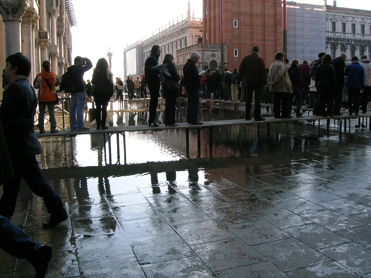
Raised boards help, but they are not everywhere.
Raised walkways
The same 2023 city page says important routes can be walked on boards up to 120 cm, and that boat lines change above 95 cm. Nobody promises that every board is in place or that every route works at a given level. Check the forecast and follow the signs.
Walkway manners
The boards are narrow and get crowded. Keep moving and do not stop to take photos in the middle. The city's sanction overview also lists sitting or eating on the ground, steps and walkways, with a fine of €100 to €200 (state of 2023).
Rules on the square →If you plan a day on the square
Keep the buildings flexible. The Campanile and the Museo Correr have their own tickets and their own opening notes, and indoor time in a museum is an easy fallback when the square is wet. Keep waterproof footwear in your bag from autumn to spring.
Museo Correr →If you stay nearby
Ask your host how the ground floor and the nearest route to the water stop behave in high water. Do not rely on a hotel listing alone.
Where to stay →For the larger picture of tides, seasons and crowds across the whole city, read the Venice best-time guide.
Plan the rest of your visit
Pages that fit a high-water forecast.
Acqua alta: frequently asked questions
Is St Mark's Square flooded in winter?
It can be, for a few hours when the forecast is high. Autumn and winter are the usual focus, but there is no fixed season and no fixed number of events per year. Check the tide forecast on the day.
At what level does the square flood?
A city page from 2023 named 82 cm for the first noticeable flooding. Works since then change the conditions, so there is no single reliable number today. Use the forecast, not a threshold.
What do the sirens mean?
An attention signal comes first. Then 1 tone means +110 cm, 2 rising tones +120 cm, 3 tones +130 cm and 4 tones +140 cm and more. The published explanation dates from November 2020.
Does MOSE keep the square dry?
MOSE protects against the worst tides. The agreed threshold for raising it is a forecast of 110 cm. It does not stop rain or waves, and local protection works were not finished in autumn 2026.
Are walkways always in place?
No. There is no promise that every board is down or that every route works at a given level. Check the forecast and plan an alternative.
Can I still visit the buildings on the square?
Each building has its own opening notes and tickets. Check them on the day, since a wet square can change how you reach the entrance.